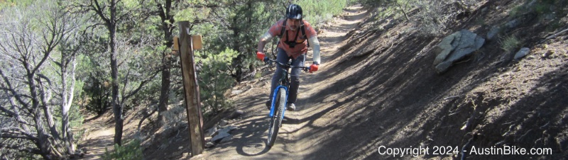
The South Boundary Trail is a classic that stretches from just outside of Angel Fire, back down to Taos, NM. It's a long trail and you'll want to grab a shuttle to the top. After about an hour in the van you're itching to get on those trails. Despite being at altitude when you are dropped off, expect some climbing as you traverse the route back to Taos.
Location: The downward end is at Taos, the altitude portion begins outside of Angel Fire
Directions: Based on the length of this trail you'll want someone to shuttle you. So, you're best to meet them where they recommend.
Technical Level: Technical level was only medium, but there are plenty of challenges with altitude
Length: Our section was roughly 22 miles, you can plan for a longer day if you want, just check with the shuttle company.
Trails: A mix of sandy and dirt trails, really smooth, mostly single track.
Trail Map: I cannot find a good map, here is the Trailforks link: https://www.trailforks.com/region/taos/
Elevation:

Shade: Pretty shady, but at altitude that does not matter as much.
Extras: none
Fees: None, but plan on a shuttle fee once you work that out with one of the local companies.
Post Ride Beer: Taos Mesa Brewing Milk Stout
Links: Official sitehttps://www.fs.usda.gov/recarea/santafe/recreation/hiking/recarea/?recid=75592&actid=50
GPS File: GPX Format
Video:


