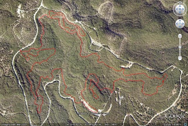
Ouch. Practice that word. If you want technical, this is your park. Think you got game? Think again. Emma is out for blood and she will get it from you, it's just a matter of time.
Known and feared throughout the Austin biking community, City Park seperates the riders from the posers. This is not recommended for beginners unless they are riding with someone else that has the patience to teach. There is so much to learn at CP that if you have the right group, you can spend an entire morning working on 5 or 6 climbs. But when you walk away your skills will be significantly better and your confidence will skyrocket.
City Park is not only a bike trail, but also a motorcycle trail. Share the trail is your responsibility because these guys ride fast and can't hear you. Just like a Yugo and a Hummer, assume that you have to yield and make yourself visible at all times.
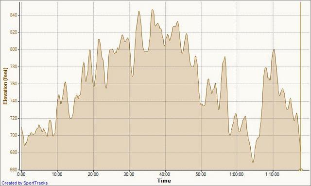
The trail is strewn with dozens of limestone ledges, from the straightforward and simple through the the most complex (the triple bitch) of ledges that will test your skills and patience. For beginners, assume that you will walk up a lot of these. A good exercise is to cound the number of times you have to dismount. Every time you come back you'll be stronger and that number should get smaller. It's a blast, but be careful, you can really rack yourself up if you're not paying attention.
Location: Northwest Austin, by 2222 and 360
Directions: Take MoPac to RM 2222, exit and head west. The first light past Loop 360 is City Park Road. Take a left here and drive about 3.7 miles. (This is past the left hand cutoff to Greenshores.) At Oak Shores Drive you should see a sign for the "Motorcycle Trails". Take the left and follow Oak Shores Dr about another quarter to half mile to the parking lot
Technical Level: High, plenty of ledges, drops, steep climbs and broken bones.