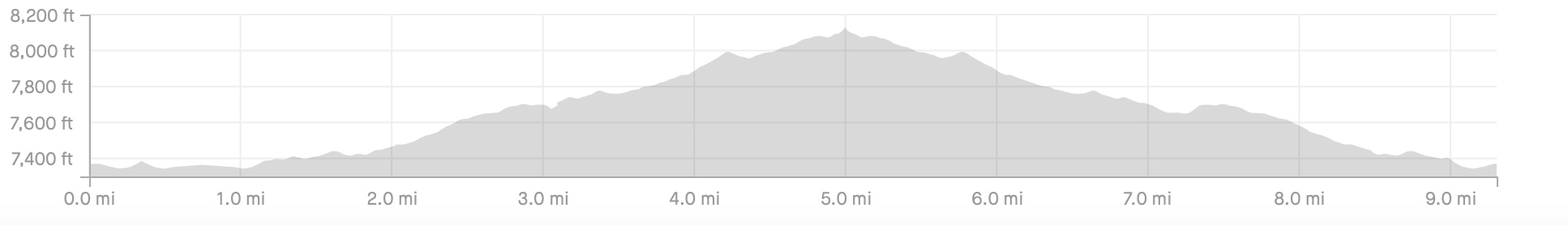
This is a big trail network down south of Santa Fe and there is a ton to ride here. Be sure to bring your climbing legs because if you want to take advantage of all of the great downhill opportunity, you're gonna need to climb up to get there.
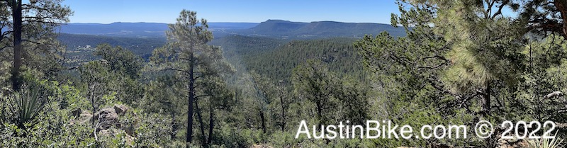
We only rode one small section and a mechanical (my crank arm breaking) caused us to do an abbreviated out and back. The views were tremendous and the trail was well maintained. It was a lot like Rocky Hill - sandy and pine trees - but with a ton of elevation. There were also spots that reminded me of RHR. I'll definitely be back to try some of the other trails in the network.
Location: Glorieta, NM, about 25-30 minutes south of Santa Fe
Directions:
Take I-25 North from Santa Fe and exit for Glorieta (Highway 50). You'll exit and cross over the highway, but instead of turning to the left to get to the main Glorieta location on Oak Road, instead turn to the right and you'll see a small building on the left, the trailhead is right there.
https://goo.gl/maps/P3zQuzpqPBD46aAQ7 (note, this will show up as a zip line tour, but it is the right place.
Technical Level: Medium to high. We rode (and climbed) the green section, there are blues and blacks. The black sections are marked with "full face helmet and pads recommended"
Trails: Rocky and sandy like much of the Santa Fe area