This is a pretty straightforward park, one big loop of around 3 miles or so with nothing challenging. This is a great place to take beginners to get them comfortable on their bikes. Supposedly there is an Onion Creek trail connected here, but I've never run across it.
Location: Southeast Austin, near the airport
Directions: Take highway 183 south from Austin, past Route 71 to McKinney Falls Parkway. Follow the signs into the park
Technical Level: Easy
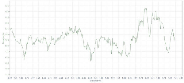
Length: About 3 miles
Trails: Flat, some jeep trails, no climbs.
Trail Map: Map
Elevation:
Shade: Medium
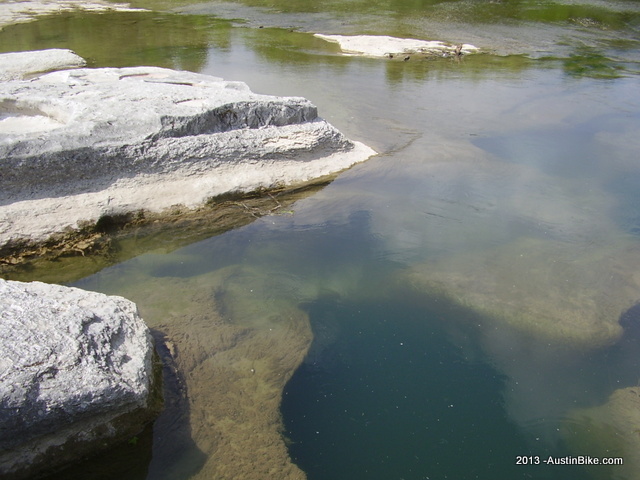
Extras: Waterfalls and a river to swim in; camping available on site
Fees: $6 entry fee
Post Ride Beer: This is on the southside and not that challenging. Have a Lone Star.
Links: Texas Parks link
GPS File: GPX Format
Video:


