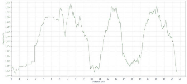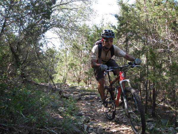
I hope you brought your lungs. Government Canyon is a lung-buster if there ever was one. The land has best been described as "half a basketball" - it is essentially a large dome with lots of trails leading up and down to a central point at the peak. The climbs are killers but the downs are great. It's pretty difficult to get lost on the trail, especially because they have great markings. However, if you take a wrong turn and are separated, it could be very easy to be apart from your group for a long time.
Location: San Antonio, TX
Directions: From the intersection of Loop 1604 and Culebra Road (also known as FM 471 - back road to Castroville), travel west 3.5 miles to Galm Road. Turn north (right) on Galm and travel 1.6 miles; gate with signs on the left.
Technical Level: Medium (high for non-climbers)
Elevation: