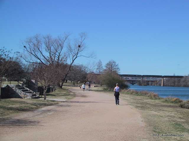
Flat. Yes, very flat. And very accessible. This doesn't really count except that it is such a popular biking route when you just want to get out and get some fresh air. Riding this trail makes you feel young again (if you're old like me) because it is full of Austin's college crowd running, walking or riding.
Location: Downtown Austin
Directions: From Austin - the path is located around Town Lake, there are at least a dozen places to park and pick up the trail. It's a big loop so don't worry about how to get there, just get there.
Technical Level: Low
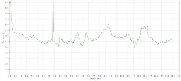
Length: 8-12 miles depending on your route
Trails: Flat graded trails with a pulverized limestone surface. Watch out for joggers, walkers and dogs, this path is highly populated. A new metal, concrete and wood boardwalk now extends the southeast portion of the trial out to I-35 with connections there and beyond.
Trail Map:
Elevation:
Shade: Medium. Many parts of the path are open to the sun and others are protected. Time of day can be a big variant here as the path is active from early in the morning until late at night. The shadow factor can have an impact.
Extras: View - this is what makes Austin great, a manageable downtown right on the lake, as well as a lake to dip into if you want to cool off.
Fees: none
Post Ride Beer: Microbrew. You're right downtown so swing up to one of the many establishments that are serving. Keep Austin weird.
Links:
GPS File: GPX Format
Video:


