I haven't had a chance to ride these yet so I don't have any commentary.
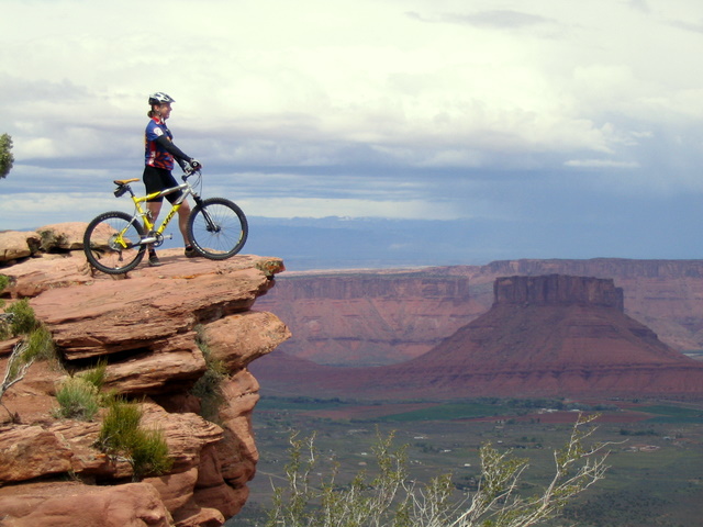
Location: Moab, UT
Directions: Head east on Center Street for 4 blocks and turn right onto 400 East. Turn left on Mill Creek Drive (at Dave's Comer Market). Take a left (at the cemetery) onto Sand Flats Road and head up towards the Slickrock Trail. Pass the kiosk heading into the Sand Flats Recreation Area and tell the nice folks there that you are heading up to Porcupine Rim. The road turns to dirt just after the Slickrock parking lot. Continue on for 6.4 miles until you find a parking lot and a dual stock tank with signs indicating the trailhead. This is your starting point (if you drove or took the shuttle: if you rode, you probably are laughing at the use of "starting point"), (from trailmonkey.com site)
Technical Level: High